The largest infrastructural linear project surveyed using an unmanned aerial vehicle in the world carried out in Croatia
The area along the left foreshore of Sava River from Račinovci (rkm 212.080) to the Trnava confluence at Nova Gradiška (rkm 464.500) is protected against floods by a continual line of river dikes covering the total length of 236 km.
The flood event of May 2014 in the area of Županja Posavina, caused by the penetration of the river dikes at Rajevo Selo and Račinovci, was the worst event since the catastrophic flood by the Sava River in Zagreb back in 1964.
The greatest problems identified were inadequate and non-uniform stability of the river dikes foundation ground and inability to access all river dikes sections during the period of implementing flood protection measures.
The project titled Modernisation of the Sava river dikes on the section covering the total length of 23 km from Račinovci to Nova Gradiška incorporates plans for the construction of a berm which provides access to the river dikes and has a positive effect on the stability of the river dikes.
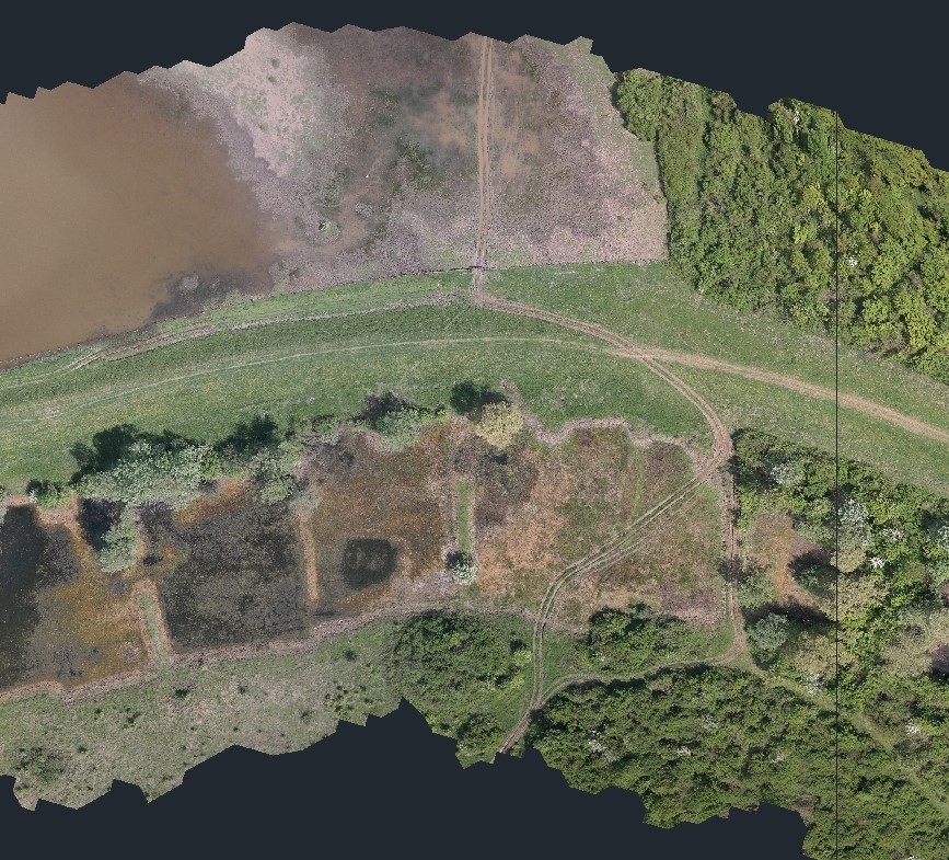
Surveying the geodetic survey map was carried out using an unmanned aerial vehicle (UAV/drone), where the length of the surveyed river dikes amounted to 236.7 km, and the width of the surveyed belt was 100 m.
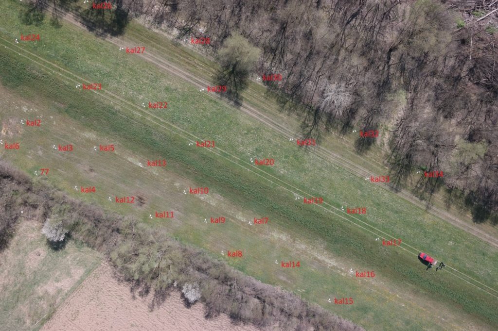
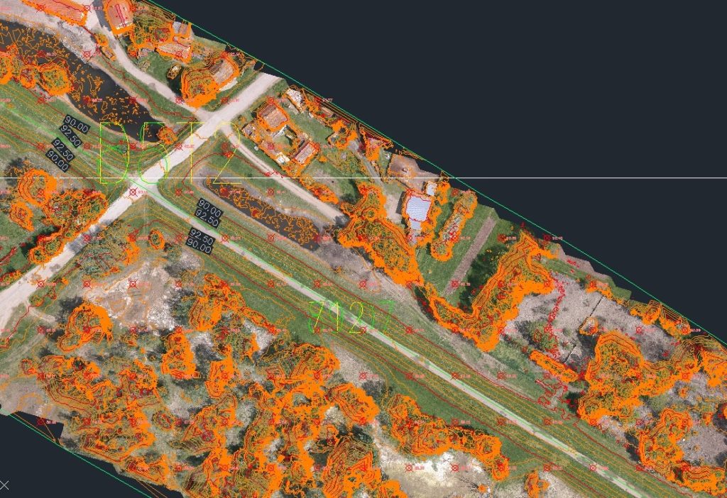
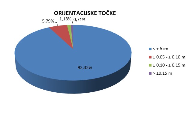
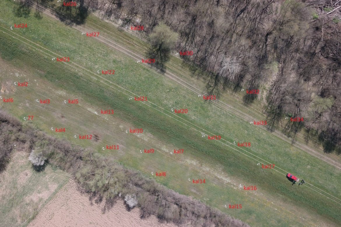
Prior to surveying, reconnaissance and photo signalling of the terrain were conducted such that subsequent data analysis provides the required accuracy of the digital model of the terrain. For the purpose of orientating a photograph, the total of 900 orientation points were distributed along the entire surveying route. To control the terrain model, another 175 control points were added.
Prior to surveying, preparation of flights was performed which consisted of planning the flight axes, flight height, flight direction and supervision of the drone.
For testing the surveying methodology, a test surveying was done in the area of Zbjeg in Slavonski Brod. In addition, a calibration field was set up across a wider area of Račinovci such that it covered the surveyed embankment belt.
Using new technologies and know-how, the largest infrastructural project in the world was surveyed using an unmanned aerial vehicle (236.7 km).